

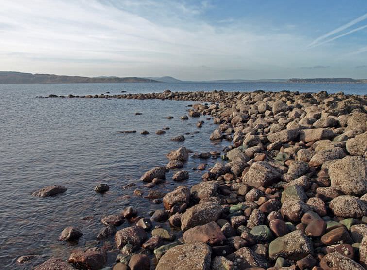
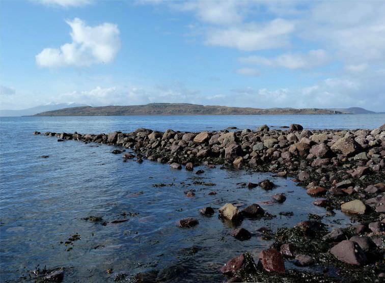
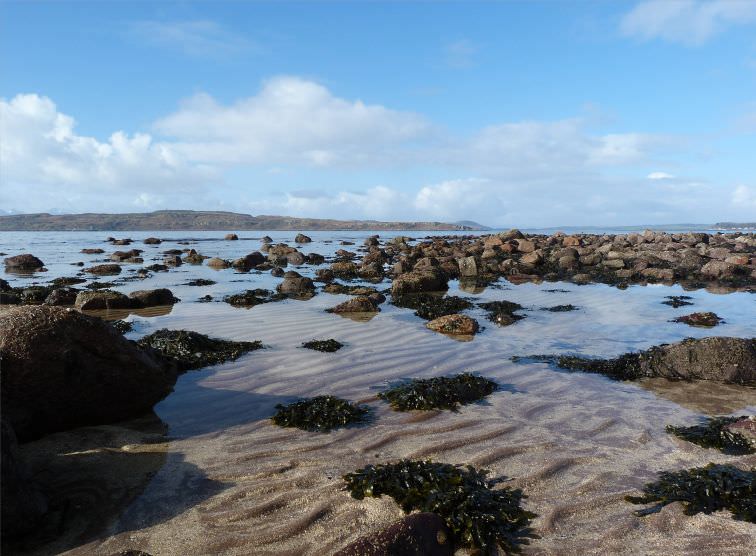
Off Brigurd Point a deep-water berth facing towards Ailsa Craig is visible at low tide. The walls of rough ’square' blocks as those of the heaviest mole are 10 feet wide, and although utterly ruined by the force of the sea, evidence a strictly linear facing along the inner north wall. The east and west wall alignments, although disturbed, even to the foundation course in places, show clear signs of artificial construction; along the north and west side the floor has been tightly cobbled for some distance from the wall.
The harbour is 156 feet wide internally across the inner end, measured at its widest between the outer ends of chamfered comers, which provide a trapezoidal outline. Towards the entrance, at least 150 feet from the north end, but never seen above water, the harbour widens. At extreme low spring tide a wall was observed closing the berth, with roughly central entrance gap, but it appeared to abut the outer and inner walls, and the inner east wall continued past it in the direction of the mole. Thus the entrance footings appear to be a secondary construction.
At high tide, according to Admiralty Charts, the present remains lie under 2 fathoms (3.81m). It is highly improbable that the walls ever rose high enough to render the harbour practicable at any time approaching the present. It is not mapped by Watt in his survey of 1734.
In Gaelic, Brig means a heap or pile, like a peat stack, but the origin of the place name is probably Norse. ( Bryggja - ord; Norse = landing place-point) .

© 1999 - 2022


- Home
- Estate Land
- Gates
- Farms
- Watertanks
- The Brooch
- Castle
- Woods
- Ha-Ha Wall
- Hills
- Burns
- Dump
- Buildings
- Turret Bees
- Walled Garden
- Shores
- Mansion House
- Roads
- Bridges
- Trees
- Quarries
- Flora & Fauna
- Marshes
- Roman Features
- Geological Fault
- Industry
- Archaeology
- Other Features
- Hunter Clan
- Various Images
- Planning Documents
- Location Map
- Donate
- Contact Me