

At the mouth of the burn gill next to gulls walk there used to be a Corn Mill and was known as Hunterston Mill. There is very little information on this building but is shown on many old maps and also the census of 1841 and 1901. It was owned and located on land belonging to the neighbouring Southanan Estate which was owned by the Montgomerie Family. It was named Hunterston after the sands and not the estate.
It is unknown when the building was demolished but in the early 1970s the land on which the mill stood became part of the British Steel yard so most likely what was left of the building was removed.
Each farm was responsible for certain amount of acreage of land and the mill was no different. The mill had 70 acre of land in 1871 and its certainly possible that once the corn mill became no longer useful it was used as an additional outbuilding for Poteath Farm. The boundery of Southannan Estate and Hunterston Estate is where the security fence is that borders Power Station Road to the A78 Main Road.
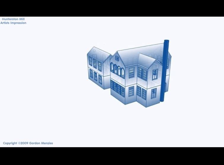
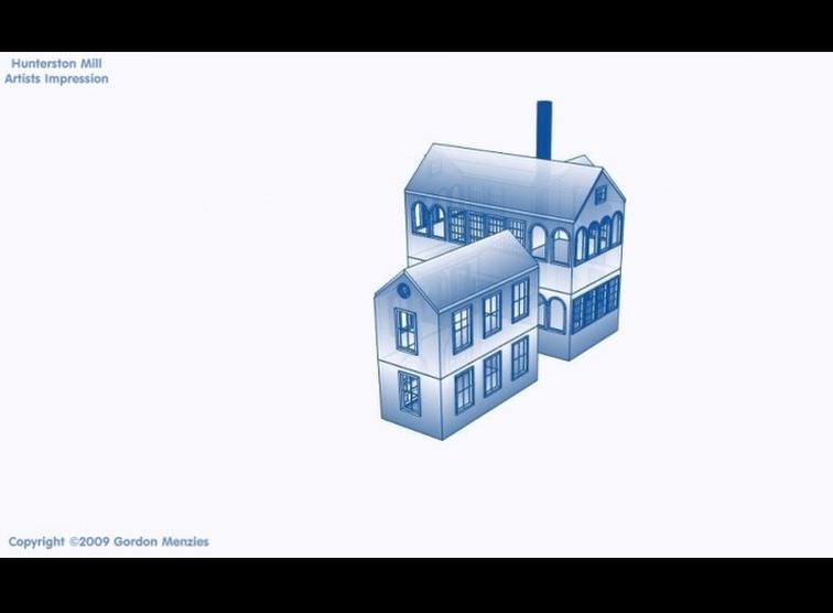
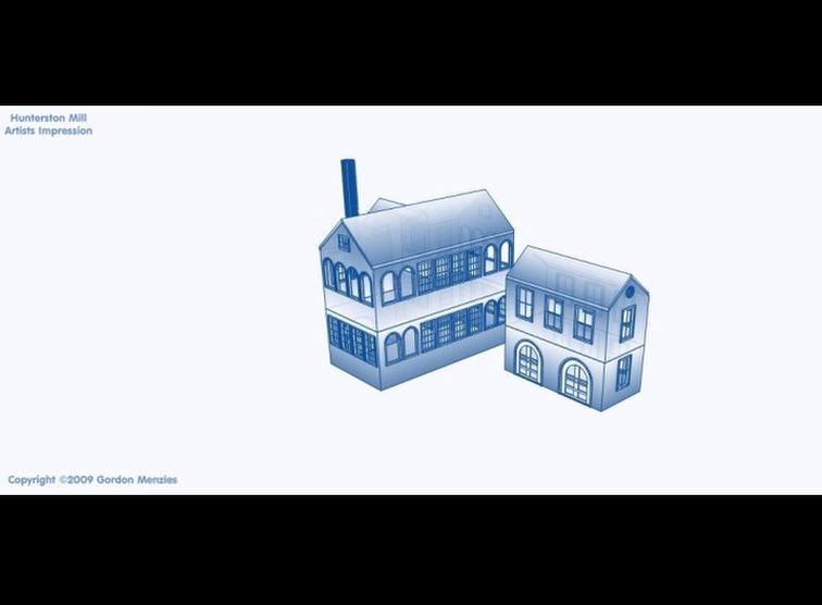
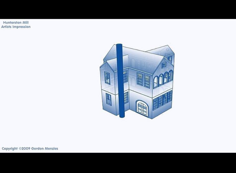
Unfortunately no images exist of the mill but using the shapes of buildings as shown on old maps and the style of buildings corn mills were based I have made a basic 3d drawing of what the mill could have looked like.
It is unknown when the building was demolished but in the early 1970s the land on which the mill stood became part of the British Steel yard so most likely what was left of the building was removed.
Each farm was responsible for certain amount of acreage of land and the mill was no different. The mill had 70 acre of land in 1871 and its certainly possible that once the corn mill became no longer useful it was used as an additional outbuilding for Poteath Farm. The boundery of Southannan Estate and Hunterston Estate is where the security fence is that borders Power Station Road to the A78 Main Road.
Unfortunately no images exist of the mill but using the shapes of buildings as shown on old maps and the style of buildings corn mills were based I have made a basic 3d drawing of what the mill could have looked like.


- Home
- Estate Land
- Gates
- Farms
- Watertanks
- The Brooch
- Castle
- Woods
- Ha-Ha Wall
- Hills
- Burns
- Dump
- Buildings
- Turret Bees
- Walled Garden
- Dump
- Shores
- Mansion House
- Roads
- Bridges
- Trees
- Quarries
- Flora & Fauna
- Marshes
- Roman Features
- Geological Fault
- Industry
- Archaeology
- Other Features
- Hunter Clan
- Various Images
- Planning Documents
- Location Map
- Donate
- Contact Me
© 1999 - 2022